Is there a wetland near you that should be included in this map?
"Myself and Paddy Crushell have been asked by Kerry County Council to draw up a complete wetland map for Kerry... to include both sites within the state SAC/ SPA / NHA network, but more importantly sites outside of the “recognised” network.
I was wondering if there were any important sites you feel should be included in such a wetland map? We are looking at both freshwater habitats (bog/fen/lake/ponds artifical or natural etc.) and brackish water (saltmarsh/lagoons/dune slacks etc.).
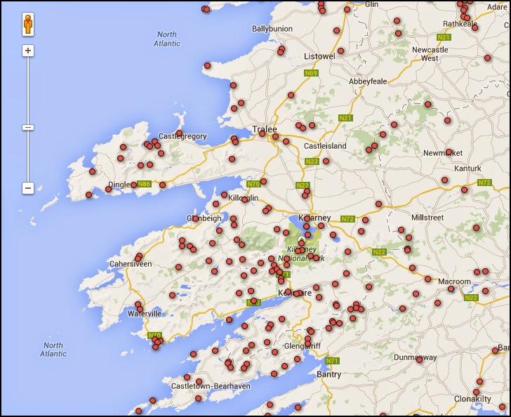
The Map of Irish Wetlands (HERE) currently has 128 sites shown in the county. We have already added another 50 or so sites based on older reports and surveys, and most again fall within the state network of sites (not currently shown on map). We are also undertaking a full screen of aerial photographs and subsoil data for Kerry to identify wetland sites outside of the state network... but this will mainly identify areas but not provide much additional information until some future survey is undertaken.
If there any sites that jump to mind that you are aware of (outside of the state network of sites) that you feel should be included I would be delighted to hear about them. All we need is name, a grid ref or screen grab for site and any other information on the area you are aware of (habitat or species info always useful). Any help would be much appreciated.
Many thanks."
Dr. Peter Foss, MIEEM
Environmental Consultant
Peter's email is HERE